A new project led by a University of Limerick researcher aims to locate, record and move towards the preservation of an ‘important heritage relic’ from nineteenth-century Ireland for the very first time.
Dr Catherine Porter, Associate Professor in Geography at UL’s School of History and Geography, is the lead researcher of ‘Locating Bench Marks, Preserving Heritage: A Community Initiative to Record County Limerick’s Ordnance Survey Heritage’.
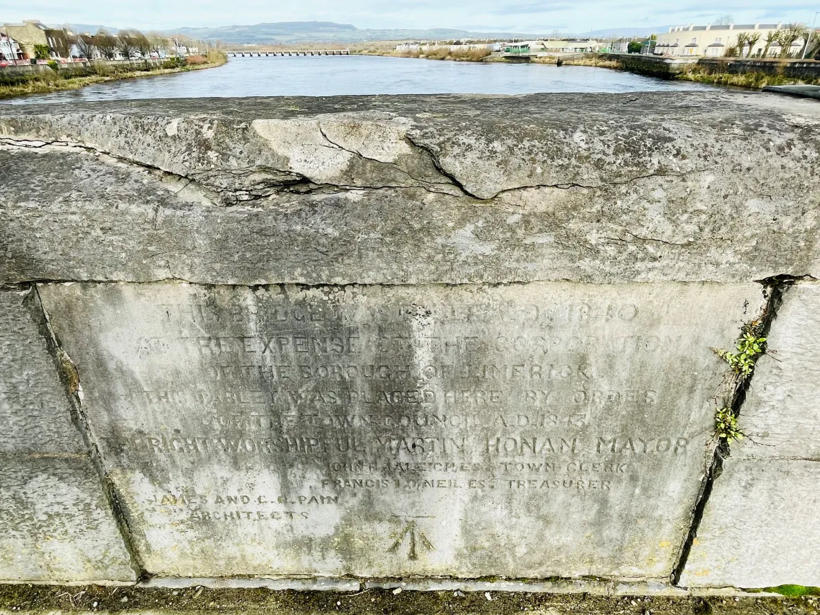
The research project aims to identify, record and archive Ordnance Survey (OS) ‘bench marks’: measuring points first carved into Ireland’s built environment – typically on buildings, bridges or walls – between 1839 and 1843.
“Bench marks, often referred to as ‘crow’s feet’ or ‘sapper’s marks’, were chiselled into Ireland’s landscape by the Ordnance Survey as part of a project to record height above mean sea level across the island. An important tangible heritage relic of the survey, that informs debates on contested heritage in Ireland, many have been destroyed or lost over the years due to demolition, development and environmental change,” explained Dr Porter.
While bench marks are a lesser-known legacy of the OS in Ireland compared to trigonometric pillars, or the early maps, and have since been replaced by more modern forms of measurement, the importance of their preservation cannot be understated. Indeed, almost 200 years on bench marks are a tangible legacy of a groundbreaking project that became a model for later mapping ventures elsewhere in the world.
Due to a lack of awareness and regard for this important form of heritage, bench marks are not afforded protected status in Ireland; and with no official statistics around their number or locations currently, Dr Porter says there is now an urgent need to raise awareness around their identification and preservation.
“For Great Britain, we have a good record of bench marks across the landscape, but for Ireland, we don’t know how many bench marks still exist; in fact, we don’t know how many were made. This project aims to change this by quantifying the loss of this significant cultural heritage,” said Dr Porter.
Supported through funding by The Heritage Council and the Faculty of Arts, Humanities and Social Sciences at UL, this digital heritage project, based in County Limerick, will have a strong community focus. Encouraged by similar efforts to record bench marks across the UK – where ‘bench mark bagging’ has been hailed as the new ‘geo-caching’ – the project aims to raise awareness of the significance of these heritage assets by harnessing community participation to locate and photograph them.
“It is our hope that through raised awareness we might move towards a greater recognition, preservation and protection of bench marks before they are lost forever. There are some avid bench mark hobbyists in Ireland, and we want to draw on their interest and that of other community groups,” added Dr Porter.
The project will use state-of-the-art digital technology to engage communities in identifying and recording the bench marks in County Limerick, and preserve these in a digital bench mark archive through Digital Repository Ireland. It is hoped that this Limerick-focused project may inform future, broader research in the area, potentially on a national scale.
The project follows the recent success of the digital humanities project, OS200, which, between 2021 and 2024, gathered historic Ordnance Survey maps and texts from the early nineteenth-century – previously held in disparate archives – to form a freely accessibly, digital resource for academics and members of the public to use.